| dc.contributor.advisor | Grønning, Marius | |
| dc.contributor.advisor | Saglie, Inger-Lise | |
| dc.contributor.advisor | Thorén, Anne-Karine Halvorsen | |
| dc.contributor.author | Zurovac, Gordana | |
| dc.coverage.spatial | Norway, Oslo | en_US |
| dc.date.accessioned | 2021-04-08T11:48:16Z | |
| dc.date.available | 2021-04-08T11:48:16Z | |
| dc.date.issued | 2020 | |
| dc.identifier.isbn | 978-82-575-1673-4 | |
| dc.identifier.issn | 1894-6402 | |
| dc.identifier.uri | https://hdl.handle.net/11250/2736878 | |
| dc.description.abstract | Over the past few decades, urban planning has been distancing itself from architecture and engineering, becoming increasingly dominated by strategic approaches and goals for sustainability. This shift of focus has created a gap, which is also possible to observe in the Norwegian planning context. Despite this gap, built structures and physical urban form still represent a significant part of the outcomes of urban planning. This empirically based PhD thesis aims to explore the physical outcomes of the current planning for densification in Norway, using Oslo as the case. The study includes two main analytical aspects: spatial and procedural.
The main research question posed in the thesis is, “What are the morphological characteristics of the physical outcomes of densification in Oslo, and what spatially related concerns have influenced the design of those outcomes?” Six sub-questions address spatial and procedural components of the analysis in further detail.
The field of urban morphology offers theoretical lenses for an integrative analysis of both the spatial and procedural aspects. In the spatial part of the analysis, the main concepts applied are urban tissue, constituted tissue, urban block, and architectural type. The spatial analysis covers the intermediate spatial scale (between a building and several urban blocks). The procedural part of the analysis encompasses three components – planning, actors, and design. The main concepts in this step are planning instrument, strategic and project plans, actors, and the articulation of physical form and architectural functions.
The study is designed as an embedded case study, with Oslo (its built-up area) as the main case and 71 multi-family residential buildings as sub-cases. In addressing each research sub-question, specific methods have been used: site visits, analysis of maps and aerial photos, document analysis and interviews.
The results expose a large variety of types of previously existing urban tissue that have undergone densification, a considerable variety of physical outputs of densification, and strong interrelations between the pre-existing urban tissue and the new structures. Among the analysed sub-cases, context-dependence appears both in terms of built form and the distribution of architectural functions. Regarding the spatially related concerns that arose in the planning processes, a number of considerations are common in the analysed cases (e.g. building heights and density), while a greater number of the considerations are site-specific, indicating that the design in densification places great attention on the immediate spatial context.
Considering the principles of the addition of new built masses at the intermediate spatial scale, the new structures have been added in numerous ways. A fairly surprising finding was that the morphological element of urban block continues to play a significant role in the design of new multi-family residential buildings. Entirely new urban blocks occur both in the pre-existing urban tissue dating from pre-modernist era and in the land-use transformation areas.
The new developments also relate to pre-existing urban blocks as additions (infills), thus contributing to a further consolidation of the pre-existing urban blocks. The study also identifies that densification in Oslo produces a particular architectural type, namely the “podium type”, and exposes its varieties relative to the topographic features of the sites.
The planning instruments at the municipal planning level (i.e., identified among the analysed cases) partially provided the inputs for the design at the intermediate spatial scale. The analysis exposes a locally adopted planning instrument in Oslo – guiding plan for public spaces (Veiledende plan for offentlige rom [VPOR]), which has been devised with the aim to provide guidelines for design of more coherent urban areas, beyond the extent of particular, individual architectural projects. This instrument indicates the need for planning practice to re-establish connections between planning and design. | en_US |
| dc.description.abstract | I løpet av de siste tiårene er byplanleggingen i økende grad blitt dominert av overordnet strategisk tenking og mål for bærekraft, og har distansert seg fra arkitektur og prosjektering. Denne endringen av fokus har skapt en kløft som også er mulig å observere i norsk planleggingssammenheng. Til tross for denne kløften, representerer bygde strukturer og fysisk byform fortsatt en betydelig del av resultatene fra byplanlegging. Denne empiribaserte PhD-avhandlingen tar sikte på å utforske de fysiske resultatene av nåværende planlegging for fortetting i Norge og bruker Oslo som case. Studien omfatter to analytiske aspekter: romlig og prosessuell analyse.
Det overordnede forskningsspørsmålet som stilles i oppgaven er: “Hva er de morfologiske egenskapene til de fysiske resultatene av fortetting i Oslo, og hvilke romlige hensyn har påvirket utformingen av disse resultatene?” Seks underspørsmål tar for seg de romlige og prosessuelle komponentene av de to analytiske aspektene.
Bymorfologi tilbyr et teoretisk perspektiv for å analysere både de romlige og prosessuelle aspekter på en integrert måte. I den romlige analysen er følgende hovedbegrep benyttet: byvev, konstituert byvev (byvev før fortetting), kvartal og bygningstype. Den romlige analysen dekker den romlige skalaen på mellomliggende nivå (mellom en bygning og flere kvartaler). Den prosessuelle delen av analysen omfatter tre komponenter: planlegging, aktører og design. Denne delen av analysen undersøker planleggingsinstrumenter, aktører og artikulering av fysisk form og arkitektoniske funksjoner.
Studien bygger på en integrert (“embedded”) casestudie med Oslo (det bebygde området) som case og 71 flerfamilieboliger som under-case. For å belyse hvert enkelt underspørsmål er følgende metoder brukt: feltstudier, analyse av kart og flyfoto, dokumentanalyse og intervjuer.
Resultatene avdekker at fortettingen i Oslo har foregått i mange forskjellige varianter av eksisterende byvev og har resultert i en stor variasjon av fortettingsformer (f.eks. infill, transformasjon, etc.). Klaresammenhenger mellom den eksisterende byveven og de nye strukturene er også identifisert. Blant de analyserte under-casene vises tegn på kontekstavhengighet både når det gjelder bygd form og fordelingen av arkitektoniske funksjoner. Analysen av casene avdekket også at noen av de romlig relaterte hensynene som ble diskutert i planprosessene, var felles (f.eks. byggehøyder og tetthet), mens flere av hensynene var stedsspesifikke. Dette indikerer at utformingen i tilknytning til fortettingsprosesser i stor grad tar hensyn til den nære romlige konteksten.
På den mellomliggende (“intermediate”) romlige skalaen, er den nye bebyggelsen innpasset på mange måter. Et noe overraskende funn var at det morfologiske elementet kvartal fortsetter å spille en betydelig rolle i utformingen av nye flerfamilieboliger. Helt nye kvartaler forekommer både i den eksisterende byveven som stammer fra førmodernistisk tid og i transformasjonsområder.
De nye boligprosjektene kan også være en utvidelse av eksisterende kvartaler (såkalte “infills”), og bidrar dermed til å konsolidere kvartalsformen ytterligere. Studien har videre identifisert at fortetting i Oslo resulterer i en bestemt bygningstype, nemlig “podiumtype”, og viser varianter av denne typen tilpasset områdets topografiske trekk.
Planleggingsinstrumentene som ble identifisert på kommunalt plannivå i de analyserte casene ga delvis innspill til prosjekteringen på mellomliggende romlig skala. Analysen avdekket bruk av et lokalt vedtatt planleggingsinstrument i Oslo – Veiledende plan for offentlige rom (Veiledende plan for offentlige rom [VPOR]). VPOR er i hovedsak utarbeidet for å gi retningslinjer for utforming av mer sammenhengende byområder, men gir noen prinsipper for de individuelle arkitektoniske prosjektene. Dette indikerer at det var et behov i (praktisk) planlegging for å gjenopprette forbindelsen mellom planlegging og design og bidro muligens til at Plan- og bygningsloven av 2008 introduserte områderegulering som et nytt planleggingsinstrument. | en_US |
| dc.language.iso | eng | en_US |
| dc.publisher | Norwegian University of Life Sciences, Ås | en_US |
| dc.relation.ispartofseries | PhD Thesis;2020:07 | |
| dc.rights | Attribution-NonCommercial-NoDerivatives 4.0 Internasjonal | * |
| dc.rights.uri | http://creativecommons.org/licenses/by-nc-nd/4.0/deed.no | * |
| dc.subject | Densification | en_US |
| dc.subject | Urban transformation | en_US |
| dc.subject | Design performance | en_US |
| dc.subject | Urban morphology | en_US |
| dc.subject | Oslo | en_US |
| dc.subject | Planning instruments | en_US |
| dc.subject | Urban blocks | en_US |
| dc.subject | Urban planning | en_US |
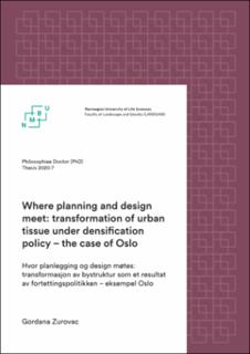
| dc.title | Where planning and design meet : transformation of urban tissue under densification policy : the case of Oslo | en_US |
| dc.title.alternative | Hvor planlegging og design møtes : transformasjon av bystruktur som et resultat av fortettingspolitikken : eksempel Oslo | en_US |
| dc.type | Doctoral thesis | en_US |


